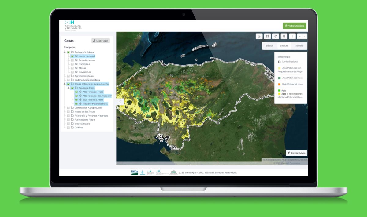
Full-stack geospatial platform built for the Honduran Ministry of Agriculture, enabling government professionals to publish agricultural map layers and citizens to explore agri-food production data across the country.
Agromapas is an end-to-end geospatial information system developed for the Secretaría de Agricultura y Ganadería (SAG) of Honduras. The platform serves two types of users. Admin users, the GIS professionals at SAG, have access to a full data publishing workflow: uploading shapefiles and rasters, publishing them to GeoServer with custom styles, linking metadata through GeoNetwork, and collecting field data via KoboCollect surveys that are then visualised as point layers on the map.
Citizen users can explore the public layers published by SAG, including agricultural zones, crop distribution, livestock areas, and other agri-food sector data across Honduras. Built with a Django backend, ReactJS frontend, OpenLayers for map rendering, and PostGIS for spatial data storage. The result is a production system that modernised how Honduras manages and communicates its agricultural geospatial data to both government professionals and the general public.